Blog
Tajikistan and the Surrounding Areas: a Brief Talk
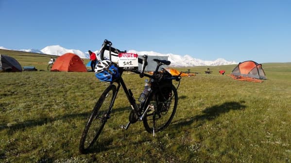
Having ridden much of the Silk Route alone in 2012 and 2013, I found myself constantly wanting to share with the Silk Route Expedition 2014 riders some of the facts and interesting titbits I’d picked up along the way and while doing research. On our final night in Kyrgyzstan, while camping in a lush green valley surrounded by nomadic shepherds, I decided that it would be a better idea if I could let all the riders know what I had learnt at the same time. After all, we were about to cross into Tajikistan so the timing was perfect.
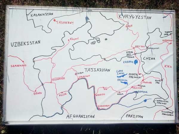
After dinner I gave a half hour talk on Tajikistan and the surrounding areas. I spent a good hour hand-drawing a map of the area on a whiteboard for the riders to follow along with. Below are most of the main facts and little stories that made up the talk, which I tried to order roughly around the route that we are all taking through Central Asia.
– The borders of most of the ‘Stan’ countries in Central Asia were drawn up by Stalin based upon which ethnicities lived where. This led to many enclaves forming with Tajiks, technically living in Tajikistan, surrounded wholly by Uzbekistan, bordering Tajikistan.
– Persian is spoken in Iran (where it is called Farsi), Afghanistan (where it is called Dari), and Tajikistan (where it is called Tajik) as all of the above were once part of the Persian empire. Iran and Afghanistan use a script similar to Arabic, as did Tajikistan until the Soviet influence changed this as they now use Cyrillic (the Russian alphabet). The languages are 90% similar to each other, with only small changes having occurred. In the Pamirs, you can find a different language in every valley you visit, with our guide, Jovid, speaking all six forms of Pamiri.
– Karakul Lake, which we passed on our first day in Tajikistan – ‘kul’ means lake, as one can tell from all the lakes in the Pamirs ending with ‘kul’, while ‘kara’ means ‘black’, as the lake is so deep it often looks such a deep blue that it is almost black.
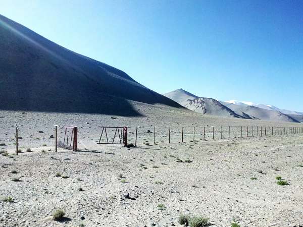
– In 2008 Tajikistan ceded thousands of square kilometres to China, meaning that China’s western frontier now borders the Pamir Highway in Tajikistan for hundreds of miles. A simple and unguarded barbed wire fence is all that draws the line, with the occasional open gate in the fence providing a perfect cross-border photo opportunity.
– Lake Sarez, lying just north of the Silk Route in the Pamirs, was formed when an earthquake caused half a mountain to fall into the river valley, forming a natural dam. To visit here you would need a Tajikistan visa, a GBAO permit and a final special permission for the lake itself.
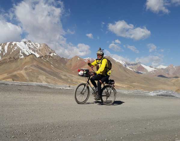
– Akbaital Pass is the highest point of the Silk Route Expedition at 4655m. The road all the way to the top is the so called (and dreaded) washboard bumps caused by the suspension of motor vehicles. When I camped near here in February 2013, the temperature in my tent dropped to -31c.
– Murghab is the largest town in the Eastern Pamirs. Its market comprises around 30 truck containers which have been turned into shops. From Murghab, a road also leads to the Kulma Pass, the only open border crossing between Tajikistan and China. Since 2008 both countries have promised that the border will soon be open to foreigners, yet still it can only be used by Tajiks and Chinese.
– Alichur, where we camped the night after Murghab, is one of the coldest places in Tajikistan, with temperatures dropping below -50c most winters.
– The Wakhan corridor is the name of the piece of Afghanistan sticking out below the Pamirs in Tajikistan and above Pakistan. During the Great Game, the Soviets, who controlled Tajikistan, and the British, which controlled Pakistan (which was then a part of India) drew up this corridor as a neutral buffer zone between the two empires. The area is mostly above 4,000m altitude and is inhabited my Kyrgyz nomads. It is the most peaceful area of Afghanistan.
– The very small (and closed) border between Afghanistan and China provides the greatest time difference between any two adjoining nations, with Afghanistan checking in at GMT+4:30 and China checking in at GMT+8
– Not too far to the south and the east from here is the Khunjerab Pass between China and Pakistan, on the Karakorum highway (Karakorum meaning ‘black gravel’). The Khunjerab pass is the highest border between any two nations on Earth and is closed in winter due to the extreme weather.
– To the south west of the Khunjerab pass is the Federally Administered Tribal Areas (FATA) in Pakistan. This is where most Taliban operations occur. If you stay on the main roads, you should in theory be protected by Pakistani police following the law of Pakistan, but if you step off the roads then the Pakistan government accepts that tribal law is in effect.
– In the south east of the Pamirs lies a small town by the name of Ishkashim. Across the river, on the Afghan side, another small village by the name of Ishkashim exists. Tourists in Tajikistan can leave their passport at the border to cross to the Afghan side to enjoy the Saturday market without any need for an Afghan visa.
– From Khorog the Silk Route follows the Panj River for the next few days. “Panj” means “five” in Persian, giving credit to the five already significant rivers that merge to form the Panj. The Panj River forms the border between Tajikistan and Afghanistan for over 900km. With Afghanistan producing over 90% of the world’s opium and heroin, this poorly protected border is just the start of the drugs’ journey out of Afghanistan, into the ‘Stans’ and then Russia, before being consumed in Europe.
– The ride along the Tajik side of the Panj Valley provides a stunning view into the unchanged way of life of the mountain people of Afghanistan, who live without roads, electricity or even motor bikes
– As is often seen in poor countries, there is a lot of aid in Tajikistan. With most of the road along the Panj River still being gravel, countries such as Iran and Turkey have taken the opportunity to erect huge signs announcing that they are going to create an 35km asphalt section of road. These often take years to build.
– Once the riders reach Dushanbe they may notice the excessive number of Mercedes Benz cars with blacked out windows, all thanks to the tremendous amount of drug trafficking that occurs in Tajikistan.
– Tajikistan doesn’t have much of its own natural resources, apart from hydro-electricity, meaning that Uzbekistan supplies Tajikistan with all of its natural gas. When I last visited Dushanbe, the presidents of these two countries had recently had an argument, meaning that the president of Uzbekistan had decided to turn off all of the gas going to Tajikistan. Not a single gas stove in Dushanbe was working, such is the ilk of these lands.


Leave a Comment for "Tajikistan and the Surrounding Areas: a Brief Talk"